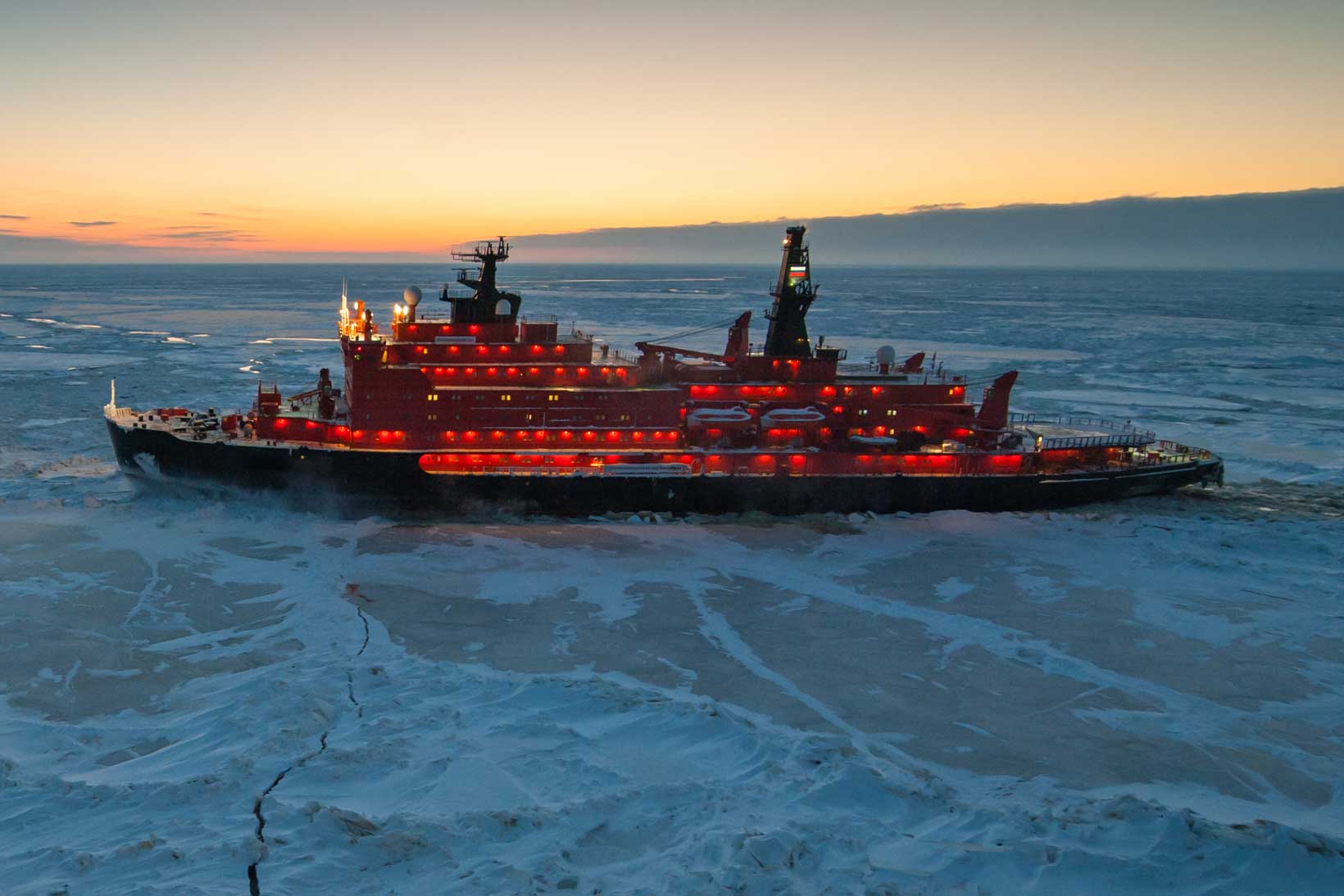
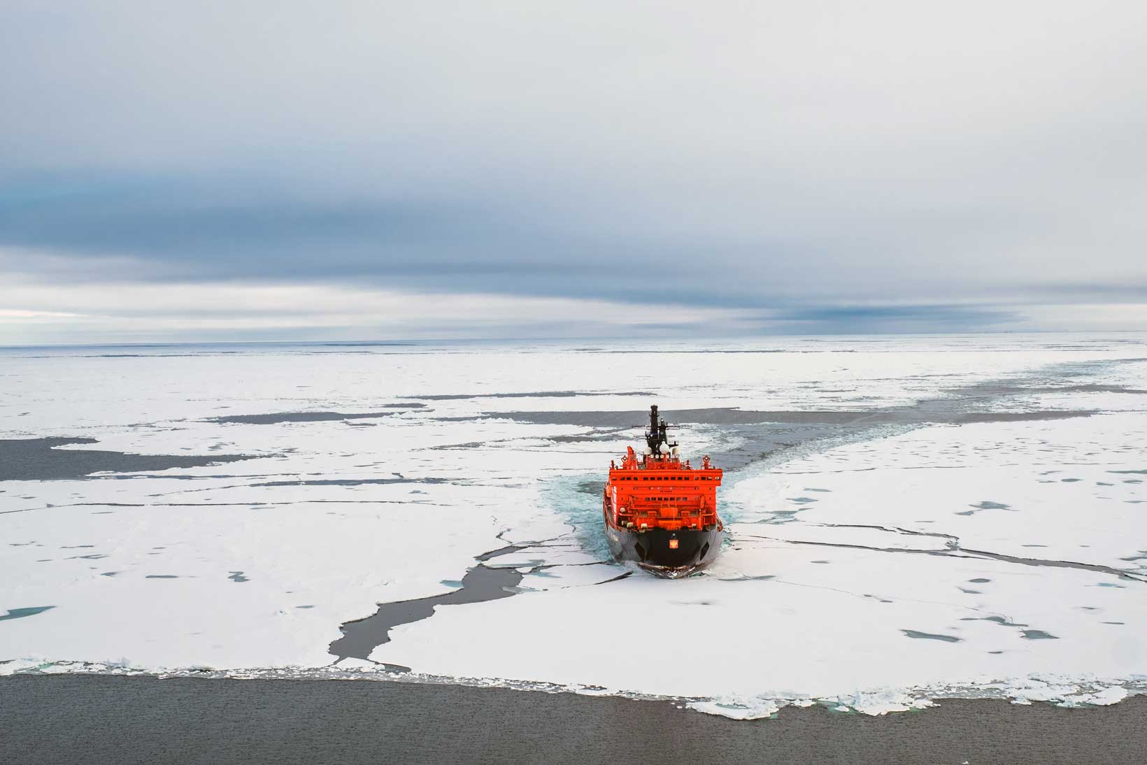
The Northern Sea route is largely ice free for 8 weeks, from August to October. Ice-strengthened vessels can sail through these shipping lanes throughout the winter with the help of Icebreakers, specially built ships that carve a guiding route through the ice. Russia has the largest nuclear powered fleet.
View from the bridge of an Icebreaker
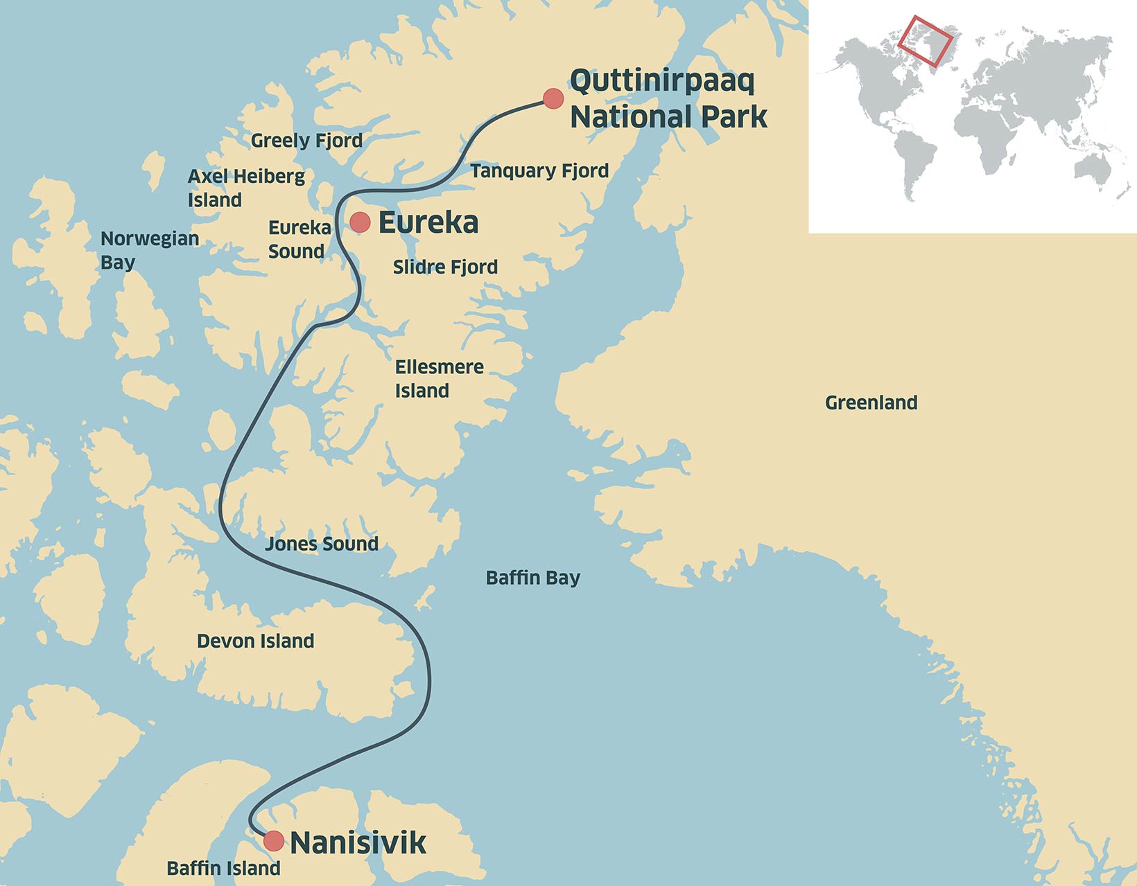
The Canadian Coast Guard
The Northwest Passage is closed throughout the winter, the ice making it impassable, but from July to October, the Canadian Coast Guard operates several icebreakers in the region, offering assistance to vessels, including cruise ships, during the Arctic shipping season, from Spring before the winter sea ice melts through to autumn when it starts forming again.
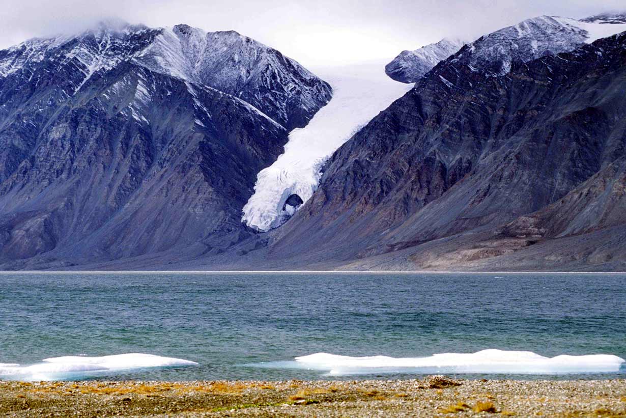
When commercial carriers are not available CCG icebreakers re-supply the Northern settlements and government sites including the Eureka weather station and the world’s northernmost park Quttinirpaaq National Park which in Inuit, means ‘land at the top of the world’.
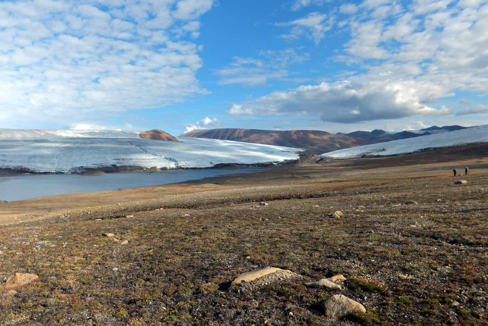
- Find out more about Quttinirpaaq National Park
Icebreakers
Building icebreakers is an expensive undertaking, with costs of up to $1.5 billion and construction time around 8-10 years. To recover costs, some of the Russian icebreakers are chartered out for commercial operations or converted into cruise ships, for a season, such as the 50 years of Victory and the Kapitan Khlebnikov.
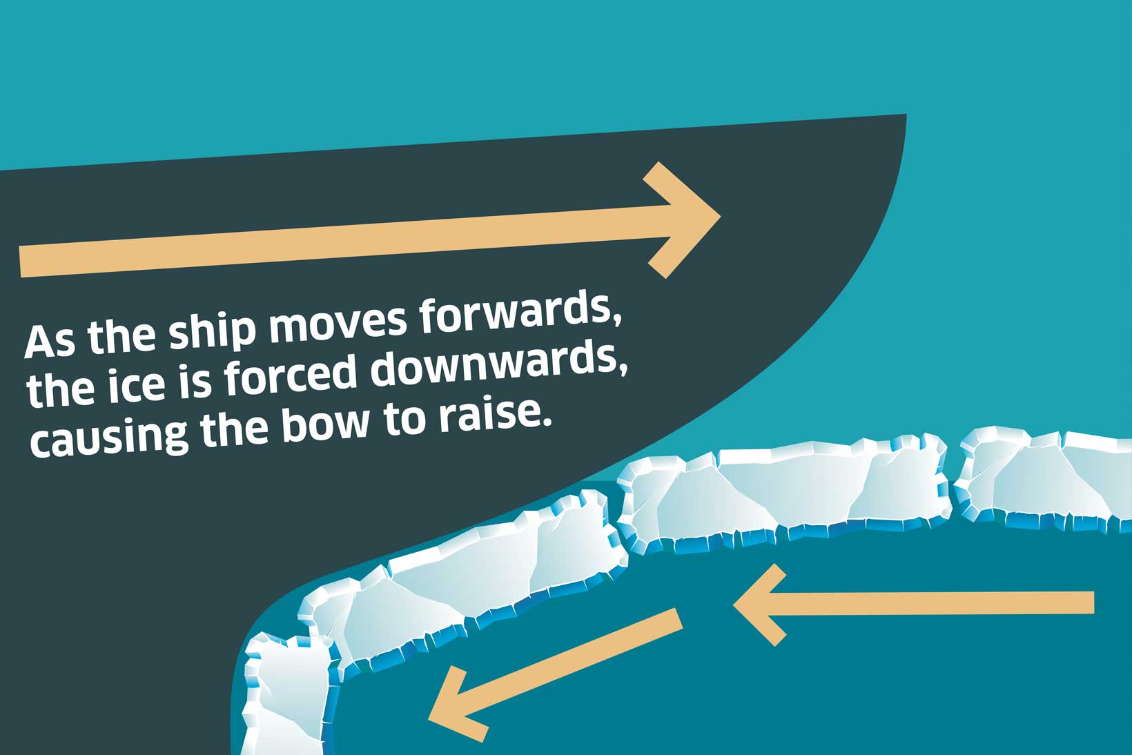
Feel the force
- Can you work out why it is easier to force down on the ice rather than force sideways?
Vessels Q&A
What is the difference between Icebreaker and Ice class and Ice Strengthened vessels?
Icebreakers are weighty ships with sloping bows, and masses of power. The icebreaker’s reinforced bow rides the ice at speed, and then comes down heavily on it to send the ice splintering asunder.
Ice Navigators
Ice Navigators work on ice breakers and ice class ships. They are certified officers with experience of working on ice. They advise and assist captains, when ships enter ice infested waters. Multi year ice is the main problem. They make ice charts and maps based on information from a selection of sources, including the following: Satellites such as Radarsat -1 and NASA’s MODIS; and the Canadian Ice Service reconnaissance aircraft, equipped with SLAR – side looking airborne radar. To have a first hand look, a ships helicopter is used. These aircraft have been modified to carry rescue equipment, including inflatable floats. Most pilots also carry a rifle, just in case they have to land where there are bears.
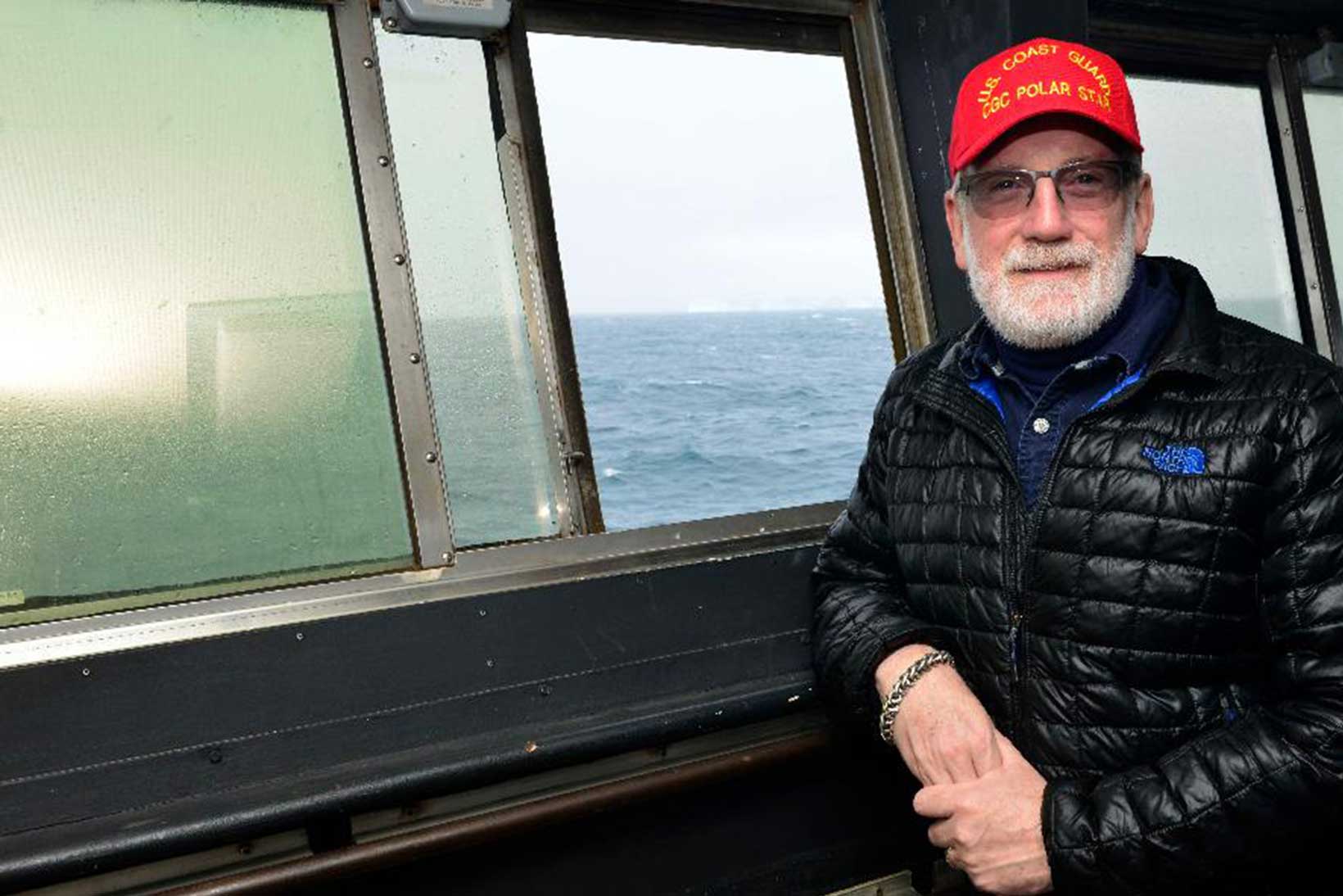
The Ice Navigator: Captain Snider
Listen to Captain Snider talking about his work as an ice navigator.
As an ice pilot or navigator, my job is to assist the Master and navigation crew of a ship transiting ice with the skills and knowledge necessary to keep the crew, ship and cargo safe. Some say it takes decades of experience operating in ice to become sufficiently knowledgeable and skilled in ice navigation and most ship’s officers don’t have that time. So ship owners and operators hire specialists such as myself to provide that experience to the regular ship’s Master and personnel. I provide interpretation of satellite ice imagery, knowledge of how ice forms, moves and presents hazards to the ship and crew; I provide insight in how to best to prepare ship and crew for navigation in ice and operation in extreme temperatures; provide navigational advice, and how to select the best routing; and will take control of the vessel with the Master’s assent, when actually maneuvering in ice.
Ice conditions are always changing, subject to decadal, annual, seasonal and daily variations. What was clear yesterday is closed tomorrow, what was an easy route last year is difficult this year, and what looked open a mile ahead of the ship may soon close and trap a ship if one doesn’t take account of the winds and currents that move the ice about the ship. With the knowledge of how the ice behaves, and the capabilities and limitations of the ship combined, the ice navigator selects the right path for the ship through the ice and manouevres as required to keep the ship safe.
It can be very much seat of the pants navigation, as the ice navigator has planned an overall route using ice charts and imagery, then metre by metre guides the ship through an ice field, eyes watching radar and ahead for openings and leads to exploit, using the power of the ship to best advantage.
It is difficult to describe the sound and motion of a ship forcing its way through ice. On the bridge, removed from the sounds, it is primarily the feel of the ship as it alternately lurches, forward and is resisted by the ice. On deck one is struck by the growling rumble of ice as it is struck by the ship, and then passes down the ships sides, tossed and pushed aside, groaning. At times, the ice can almost seem to squeal and scream as it scrapes by the steel hull. Sometimes, when the ice is under pressure, loud cracks, almost explosive like, are heard as the ice suddenly fractures and erupts along the ships side.
Captain David Snider FNI FRGS
Being an ice navigator
- What do you think it would be like to work on an icebreaker or ice class ship sailing Arctic waters? what problems do you think you might face?
Imagine you are an ice navigator in the Arctic:
- Write an ice report for the captain – describe the conditions you’ve observed.
- Write a blog entry for your family and friends – describe the conditions on board for yourself and the crew.
- National Snow and Ice Data Center on Google Earth