People have lived at the 'top' of the world for thousands of years. For those living in the south, it has caused much speculation on what might be in this northern region.
Introducing the Arctic
Situated at the northernmost part of our planet, the Arctic is a meeting point of the European, north America and Asian continents. At its heart is ocean spanning 5.4 million square miles (14.09 million square km), much of it permanently covered in ice, surrounded by land of the 8 Arctic States. Together, the Arctic comprises nearly 4% of the Earth’s surface. Around 4 million people live in the Arctic, over 10% of whom are Indigenous.
The Arctic is a place of extremes. Temperatures as low as -70oC have been recorded in winter in Greenland, while in 2024 Svalbard recorded its highest ever temperature of 21.7oC. In winter, the Arctic experiences complete darkness, punctuated only by the northern lights, while in summer 24-hour daylight supports a rich diversity of life. This has allowed people to live there for thousands of years with some evidence of human habitation dating back 40,000 years.
But the Arctic is changing fast. It is warming in places at up to 4 times the global average, meaning that glaciers are melting, sea ice is retreating, and permafrost is thawing. Greenland is on average losing 30 million tonnes of ice every hour. This is already having local and global consequences, such as on weather, climate, food security and infrastructure.
As the ice melts growing global interest in the Arctic heralds a new era of geopolitical competition for resources from fish to critical minerals, and from energy to shipping routes. This will have implications for the lives of people living in the Arctic, as well as people around the world.
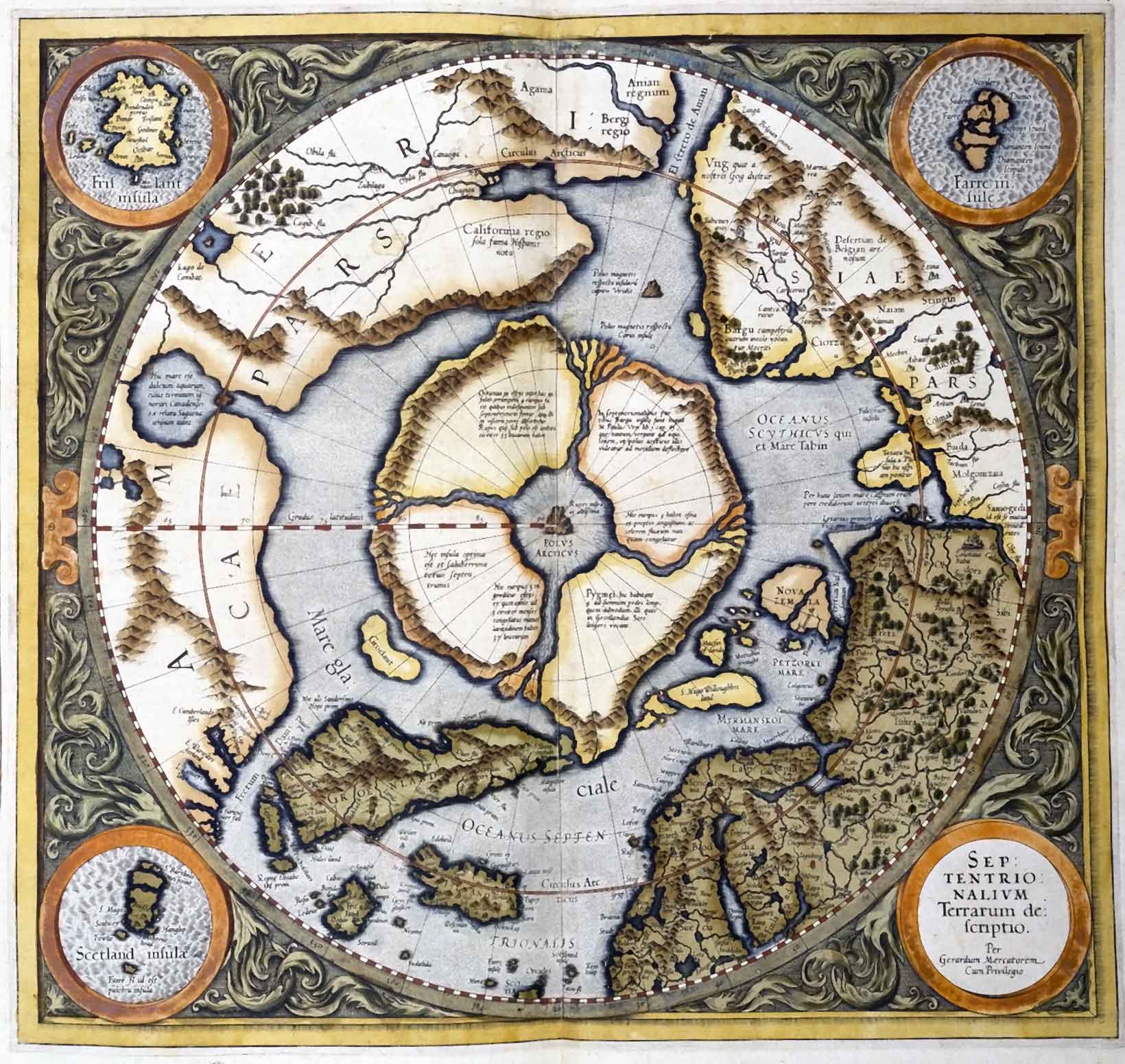
The Mercator map of 1595
The Mercator map was drawn from existing maps, the journeys of English explorers and Mercator’s theories on the location of the magnetic north pole.
There are many different definitions of the Arctic
- The Arctic Circle is the latitude at which the sun does not set at the summer solstice, 66° 33′ N
- The Arctic is the area above the tree line
- The boundary of the Arctic is the line at which the average temperature of the warmest month is 10°C (summer isotherm)
- The Arctic is where the warm salty water of the Atlantic and Pacific meet the colder less salty waters of the Arctic Ocean
- The Arctic is north of latitude 60°
How to define the Arctic
- Which of the above definitions do you think is the right one?
- How might the effects of climate change alter these definitions?
- Download the Arctic Flora and Fauna: Status and Conservation report to help you with your research.
Boundaries
The map below shows the boundaries that have been used by the Arctic Monitoring and Assessment Programme (AMAP) and the Arctic Human Development Report (AHDR) in developing strategies for Arctic governance.
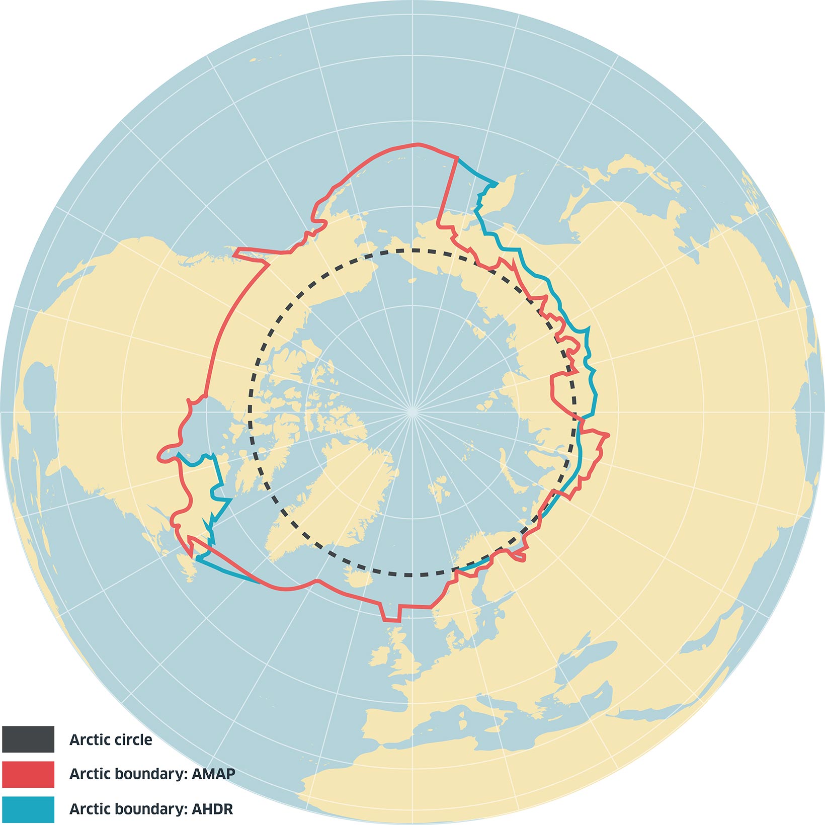
The AMAP boundary runs through latitude 50°N in North America. If this was the case in Western Europe, Britain would be in the Arctic!
- Why is this not the case? (here’s a clue: look at the map of ocean currents)
Lowest temperature!
Visiting the coldest town in the world | 60 Minutes Australia
Oymyakon – 63.46N 142.79E – claims the record for the lowest temperature recorded in a permanent settlement in the northern hemisphere at -71.2°C in 1926. It has a population of 500 and is sometimes called the northern Pole of Cold.
Verkhoyansk (67.55N 133.39E) has a population of 753 (2024 estimated). The town holds the Guinness World Record for the greatest temperature range on Earth of 106°C.
- What might be the cause of this phenomenon and are these settlements located in the Arctic?
- Oymyakon on YouTube: Find out more about what is like to live in these extreme conditions.